


Best Hiking Trails in North Wales
9 Best Hikes in North Wales 2026: Routes & Difficulty Ratings
North Wales has the finest mountain hiking in Britain — a compact region containing three national parks, the highest peaks in Wales and England, glacial lakes, ancient ridgelines and coastal cliff paths on Anglesey that offer some of the most dramatic walking in the country.
Whether you are aiming for the summit of Yr Wyddfa (Snowdon), the wild ridges of the Rhinogydd or the quiet beauty of Aber Falls, this guide covers nine of the best hikes in North Wales for 2026, with full difficulty ratings, distances, parking details and where to stay near each trailhead.
North Wales Hiking Difficulty Ratings
Easy — Clear paths, minimal elevation, suitable for most fitness levels. Walking boots recommended.
Moderate — Sustained climbing or rough terrain. Good fitness and proper mountain kit required.
Hard — Significant elevation, remote terrain or navigation required. Hillwalking experience essential.
Expert — Scrambling, serious exposure or very remote terrain. Not suitable for inexperienced walkers.
1. Moel Siabod — Best All-Round Hike in Snowdonia
Difficulty: Moderate | Distance: 7 miles | Elevation: 730m | Time: 4–5 hours | Start: Pont Cyfyng car park, Capel Curig, LL24 0EN
Moel Siabod (872m) is the finest moderate hike in North Wales for the views-to-effort ratio — a classic mountain day from the village of Capel Curig that finishes on a broad summit with one of the best panoramas in Eryri (Snowdonia).
The Snowdon massif, the Glyderau, the Carneddau, the Moelwynion and on clear days the Llŷn Peninsula are all visible simultaneously from the summit.
The ascent via the southeast ridge is sustained but straightforward; the return via the rocky northwest ridge involves easy scrambling on good rock.
The approach from Pont Cyfyng passes the beautiful Llyn y Foel — a glacial cirque lake reflecting the summit above — before the final pull to the ridge. The whole route is well-trodden and the path is clear throughout.
Capel Curig at the start has a good café (the Pinnacle Café, a North Wales institution) and a well-stocked outdoor gear shop.
Trailhead parking:
Click here for Pont Cyfyng car park, Capel Curig Coordinates
Free parking; limited spaces — arrive early on weekends.
Post-hike food:
Pinnacle Café, Capel Curig — excellent coffee, hot food and cake. Also the Bryn Tyrch Inn in Capel Curig for post-walk meals.
Where to stay near Moel Siabod:
Capel Curig and the surrounding Conwy Valley have excellent Snowdonia holiday cottages within minutes of the trailhead.
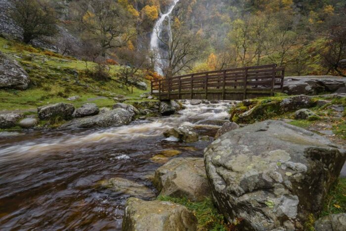
2. Aber Falls (Rhaeadr Fawr) — Best Easy Waterfall Hike in North Wales
Difficulty: Easy | Distance: 4 miles | Elevation: 170m | Time: 2–2.5 hours | Start: Bont Newydd car park, Aber, LL33 0LP
Aber Falls (Rhaeadr Fawr) is the finest easy hike in North Wales — a short, straightforward walk through ancient oak woodland to a spectacular 37-metre waterfall at the base of the Carneddau mountains near Bangor.
The path is well-surfaced and clear throughout; the final 200 metres to the waterfall base involves some rougher ground but remains accessible.
The falls are at their most dramatic after heavy rain, when the volume of water is extraordinary.
A second smaller fall — Rhaeadr Bach — is visible to the left as you approach the main waterfall and can be reached via a slightly rougher path.
The woodland reserve is a National Nature Reserve and one of the best in North Wales for wildflowers in spring and autumn colour in October.
This is an ideal hike for families with older children, mixed ability groups and anyone wanting a spectacular reward for minimal effort.
Trailhead parking:
Click here for Bont Newydd car park Coordinates
Pay and display. 10 minutes from the A55 near Llandygai.
Post-hike food:
The Douglas Arms in Bethesda (10 minutes by car) for pub lunches; Bangor city centre (15 minutes) for a wider range of cafés and restaurants.
3. Cader Idris (Cadair Idris) — Best Mountain Hike in South Snowdonia
Difficulty: Hard | Distance: 8 miles (Pony Path) | Elevation: 890m | Time: 5–7 hours | Start: Ty Nant car park, near Dolgellau, LL40 1TL
Cader Idris (Cadair Idris — “the Chair of Idris”) is the great mountain of southern Snowdonia.
A hulking, brooding massif above Dolgellau whose summit ridge at 893 metres is strung between a series of rocky peaks above glacial cwms and dark, legend-filled lakes.
Welsh mythology holds that anyone who sleeps on the summit overnight will wake either a poet or a madman.
The reality is that it is one of the finest and most dramatic mountain days in North Wales, with views stretching from Cardigan Bay to the Brecon Beacons on clear days.
The most popular route — the Pony Path from Ty Nant — follows a clear, well-maintained path via the ridge above Llyn y Gadair to the summit of Penygadair.
The ascent involves sustained climbing at moderate gradient on good paths; the upper section becomes more rocky and exposed near the summit.
The descent can be made via the same route or extended as a horseshoe over the Mynydd Moel ridge.
Trailhead parking:
Click here for Ty Nant car park coordinates
Pay and display.
Alternative start from Minffordd (south side) via the steeper but spectacular Minffordd Path.
Post-hike food:
Dolgellau town centre (10 minutes from Ty Nant) has excellent cafés including Y Sospan and T.H. Roberts coffee shop. The Stag Inn is a reliable post-walk pub.
Where to stay near Cader Idris:
Dolgellau has excellent B&Bs; the surrounding valleys have outstanding holiday cottages within easy reach of the trailhead.
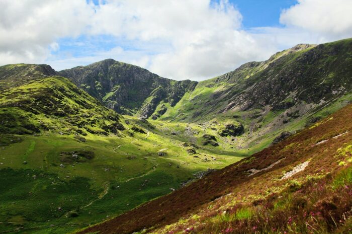
4. Cwm Idwal & the Glyderau — Best Intermediate Mountain Hike in Snowdonia
Difficulty: Moderate to Hard | Distance: 6 miles (Cwm Idwal circular with Glyder Fawr extension) | Elevation: 730m | Time: 4–6 hours | Start: Ogwen Valley car park, A5, LL57 3LZ
The Glyderau are the most otherworldly mountain range in North Wales
A plateau of shattered, fractured rock and bizarre geological formations including the Cantilever Stone (a giant rock slab projecting horizontally into space) and the Devils Kitchen (a deep vertical cleft in the headwall above Cwm Idwal).
The approach via the glacial lake of Llyn Idwal is straightforward; the upper mountain becomes increasingly wild and rocky as you ascend.
Glyder Fawr (1,001m) and Glyder Fach (994m) are the two main summits; the rocky plateau between them, littered with frost-shattered boulders, is unlike anything else in Wales.
Strong walkers can combine both summits in a single day; the Cwm Idwal circular alone (3.5 miles, easy) is a rewarding and accessible alternative for those who want mountain scenery without the full ascent.
Trailhead parking:
Click here for Ogwen Valley car park coordinates
Pay and display;
National Trust café and Mountain Rescue base at the car park.
Post-hike food:
National Trust café at Ogwen Valley — limited menu but excellent location. Betws-y-Coed (15 minutes by car) for a wider range.
5. Conwy Mountain Circular — Best Short Hike in North Wales Near the Coast
Difficulty: Easy to Moderate | Distance: 5 miles | Elevation: 250m | Time: 2.5–3.5 hours | Start: Conwy town car parks, LL32 8BB
Conwy Mountain (Mynydd y Dref) rises directly behind the medieval walled town of Conwy to 244 metres — modest in height compared to Snowdonia’s giants but disproportionately rewarding for the effort.
The summit ridge gives views across Conwy Bay, the Isle of Anglesey, the Great Orme headland and on clear days the mountains of the Lake District across the Irish Sea.
The Iron Age hillfort of Caer Lleion on the summit is one of the most complete in North Wales.
The walk starts from Conwy town itself, passing through the town walls and climbing moorland paths to the summit ridge.
The circular route can be extended along the Sychnant Pass for a longer day.
This is the ideal hike to combine with a visit to Conwy Castle and the medieval town walls — a full and enormously satisfying day in one of the finest historic towns in Wales.
Trailhead:
Start from Conwy town — parking in the town car parks (LL32 8BB).
Walk from the castle walls up Mountain Road to access the open moorland.
Post-hike food:
Conwy town has excellent options — the Watson’s Bistro, the Quay Hotel brasserie and several good cafés on the High Street all within the medieval walls.
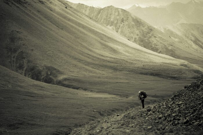
6. The Rhinogydd Ridge — Best Wild & Remote Hike in North Wales
Difficulty: Hard | Distance: 10–14 miles (various routes) | Elevation: 700–900m | Time: 6–8 hours | Start: Cwm Bychan (near Llanbedr), LL45 2PH
The Rhinogydd are the wildest and least-visited mountain range in Eryri (Snowdonia)
A series of bouldery, heathery ridges between the Mawddach Estuary and the Traeth Bach tidal estuary, with no main roads crossing them and paths that disappear into heather and bilberry on the higher ground.
Walking here feels remote in a way that the more popular Snowdon area rarely does. T
The Roman Steps — an ancient trade route paved with flat slabs through the Bwlch Tyddiad pass is the most distinctive feature, with a history stretching back at least to the medieval period.
The main summits — Rhinog Fawr (720m) and Rhinog Fach (711m) involve rough, pathless terrain between the two; a good OS map, compass and hillwalking experience are essential.
The reward is total solitude in an extraordinary landscape: golden eagles have been recorded here, and the Rhinogydd are one of the few places in Wales where you might genuinely walk all day without seeing another person.
Trailhead parking:
Narrow lane from Llanbedr — unsuitable for large vehicles.
Where to stay near the Rhinogydd:
Harlech (6 miles west) has excellent holiday cottages with views of the castle and the mountains.
Barmouth (10 miles south) gives Mawddach Estuary access combined with Rhinogydd walking.
7. Yr Wyddfa (Snowdon) via the Llanberis Path — Best Beginner Summit Hike in North Wales
Difficulty: Moderate | Distance: 9 miles round trip | Elevation: 1,000m | Time: 5–7 hours | Start: Llanberis car park, LL55 4TY
The Llanberis Path is the most accessible route to the summit of Yr Wyddfa (Snowdon) — the highest mountain in Wales and England at 1,085 metres is the recommended route for fit beginners attempting their first major Welsh mountain.
The path follows the line of the Snowdon Mountain Railway for most of its 4.5 miles, gaining height steadily on well-graded tracks before the final pull to the rocky summit plateau.
The Hafod Eryri summit visitor centre (open in season) provides shelter, refreshments and extraordinary 360-degree views.
The summit on a clear day reveals a panorama stretching from Pembrokeshire to the Isle of Man, from the Wicklow Mountains in Ireland to the Brecon Beacons.
The Snowdon Mountain Railway (from around £47 return) provides the option of an assisted ascent or descent for those who find the gradient more challenging than anticipated.
Trailhead parking:
Numerous car parks in Llanberis; arrive by 8am on summer weekends to avoid queuing.
The bus from Caernarfon and Bangor is recommended.
Post-hike food:
Llanberis is excellent for post-walk food — Pete’s Eats is the legendary walkers’ café, open from 8am for hearty breakfasts and lunches.
8. Mynydd Mawr — Best Hidden Gem Hike Near Snowdon
Difficulty: Moderate | Distance: 7 miles | Elevation: 695m | Time: 4–5 hours | Start: Rhyd Ddu car park, LL54 6TN
Mynydd Mawr (695m) is one of the best lesser-known hikes in North Wales — a broad summit directly above Rhyd Ddu that rewards walkers with an uncrowded viewpoint looking directly across at the Snowdon massif.
While Yr Wyddfa itself can be packed with thousands of walkers on summer weekends, Mynydd Mawr typically has fewer than a dozen people on its summit on the same days.
Yet the views of Snowdon from here are arguably better than those from the top. An excellent alternative to the Snowdon routes for those who want the scenery without the crowds.
The ascent from Rhyd Ddu follows a clear path past the lonely Llyn Cwellyn reservoir before climbing moorland slopes to the summit.
The Welsh Highland Railway stops at Rhyd Ddu — arriving by steam train from Caernarfon or Porthmadog is a memorable approach to the walk.
Trailhead parking:
Rhyd Ddu National Trust car park
Free parking; limited spaces — the Welsh Highland Railway station is adjacent.
9. The Carneddau Horseshoe — Best Long Mountain Hike in North Wales
Difficulty: Hard | Distance: 12 miles | Elevation: 1,200m | Time: 7–9 hours | Start: Ogwen Valley car park, LL57 3LZ
The Carneddau are the largest mountain massif in Wales — a vast, rolling high plateau north of the Ogwen Valley with five summits above 900 metres, roaming semi-wild ponies and the most remote mountain terrain in Snowdonia.
The Carneddau Horseshoe from Ogwen takes in Pen yr Ole Wen (978m), Carnedd Dafydd (1,044m), Carnedd Llewelyn (1,064m — the third highest mountain in Wales and England) and Pen yr Helgi Du (833m) in a single long day over open, largely pathless moorland.
This is a serious mountain day for experienced walkers — good navigation skills, full mountain kit and an early start are essential.
The Carneddau ponies — descendants of a herd that has roamed these mountains for centuries — are one of the most extraordinary sights in Welsh upland walking.
The plateau feels genuinely arctic in winter conditions, with substantial snow cover possible from November to April.
North Wales Hiking FAQ: Routes and 2026 Trail Tips
What is the best hike in North Wales?
For experienced walkers, the Snowdon Horseshoe (via Crib Goch) and the Carneddau Horseshoe from Ogwen are the two finest full mountain days in North Wales. For a moderate day with outstanding views, Moel Siabod from Capel Curig is the best all-round choice. Cader Idris via the Pony Path is the best mountain day in southern Snowdonia. For an easy walk with spectacular rewards, Aber Falls and the Cwm Idwal circular are both exceptional.
How long does it take to climb Cader Idris?
The Pony Path route up Cader Idris from Ty Nant near Dolgellau takes most walkers 5–7 hours for the full round trip, including time at the summit. Fit, experienced walkers may complete it in 4–5 hours. The Minffordd Path from the south is slightly shorter but steeper. Allow a full day and start no later than 10am to ensure comfortable return before dark in autumn and winter months.
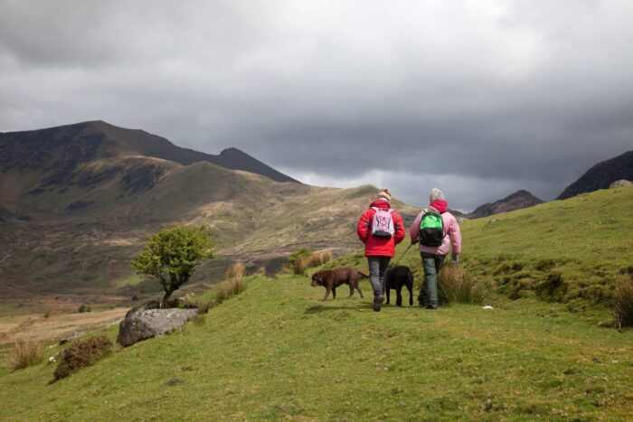
Are North Wales hikes dog-friendly?
Many North Wales hiking trails are dog-friendly, but with important conditions. Dogs must be kept on a lead near livestock — particularly on the Carneddau (wild ponies and sheep) and during lambing season (March to May) across all hill areas. Aber Falls and Conwy Mountain are excellent dog-friendly walks. The Snowdon summit is accessible with dogs but the Snowdon Mountain Railway does not allow dogs in the main carriages (a separate dog carriage is sometimes available). Always carry water for your dog on mountain days.
What is the best base for hiking in North Wales?
Betws-y-Coed is the most central base for hiking across Snowdonia — within 30 minutes of Moel Siabod, Cwm Idwal, the Glyderau, Cader Idris and the Rhinogydd. Llanberis is the best base specifically for Yr Wyddfa (Snowdon) and the Llanberis area. Dolgellau suits walkers focusing on Cader Idris, the Rhinogydd and the Mawddach Estuary. For Aber Falls and the Carneddau, Bethesda or the Ogwen Valley area is ideal.
For more walking and adventure inspiration across Wales, see our guides to the best day hikes in Wales, the best mountain walks in Snowdonia, and mountain biking in Snowdonia.
EXPLORE MORE NORTH WALES TRAVEL GUIDES

Nick, your trusted guide to Wales travel and exploration, shares a deep passion for this enchanting land. With years of exploration, Nick offers expert insights into the best of Wales. Join him on a journey through its captivating history, culture, and hidden gems, as he inspires you to create unforgettable Welsh travel experiences.
Planning a trip to Wales?
Find the perfect holiday cottage for your Welsh adventure.


