Venture on the Four Waterfalls Walk in the Brecon Beacons
Four Waterfalls Walk 2026: Brecon Beacons Waterfall Country Guide
By the Wales.org Travel Team | Updated April 2026

The Four Waterfalls Walk is one of the most spectacular walks in Wales. A circular trail through ancient woodland in Bannau Brycheiniog (Brecon Beacons) National Park, it follows the Afon Mellte and Afon Hepste rivers past four waterfalls — each with its own character — and climaxes at Sgwd yr Eira, where you can walk behind a thundering curtain of water. The trail is set in an area known as Waterfall Country, which has more waterfalls per square mile than anywhere else in Wales.
This guide covers everything you need to know to walk the Four Waterfalls in 2026: the route, the car parks, each waterfall described, safety advice, what to wear, and the best time to visit.
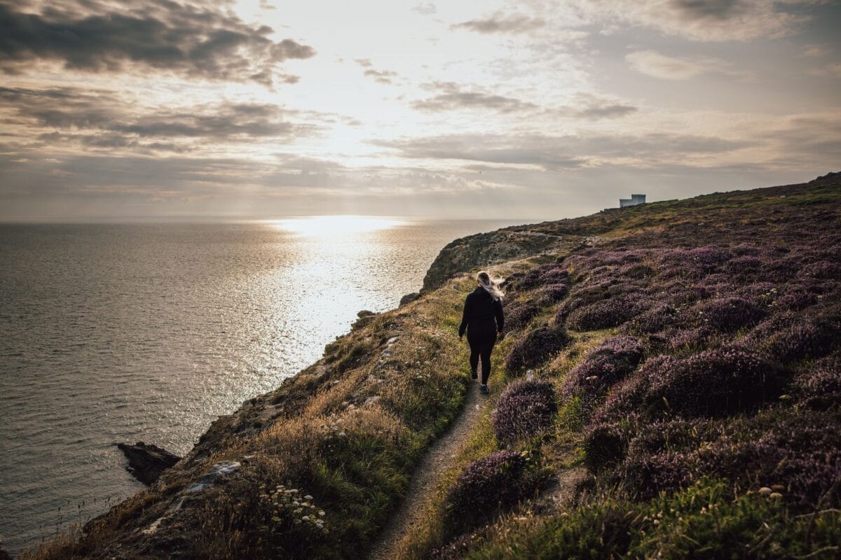
At a Glance: Four Waterfalls Walk
- Distance: Approximately 4.5 miles (7.6km) circular from Cwm Porth; 5.3 miles (8.5km) from Gwaun Hepste.
- Time: 3–4 hours (plus time at waterfalls).
- Difficulty: Moderate — steep, muddy linking trails to waterfall bases, some rocky steps. Main woodland path is easier.
- Highlight: Sgwd yr Eira — walk behind the waterfall.
- Parking: Cwm Porth (CF44 9JF, £5, toilets) or Gwaun Hepste (£5, largest). Comin y Rhos (SA11 5US, free, <10 spaces).
- Best season: Spring and autumn (waterfalls fullest after rain). Summer is drier but less dramatic.
- Dog-friendly: Yes (on lead).
- Pushchair/wheelchair accessible: No.
The Four Waterfalls
| Waterfall | English Name | River | Character | Walk Behind? |
|---|---|---|---|---|
| Sgwd Clun-Gwyn | Fall of the White Meadow | Afon Mellte | Two-tiered, viewed from platform | No |
| Sgwd Isaf Clun-Gwyn | Lower Fall of the White Meadow | Afon Mellte | Multi-tiered, woodland setting | No |
| Sgwd y Pannwr | Fall of the Fuller | Afon Mellte | Heavy cascade, deepest pools | No |
| Sgwd yr Eira | Fall of the Snow | Afon Hepste | Wide curtain, walk-behind ledge | Yes |
The Route: Step by Step From Cwm Porth
We recommend starting from Cwm Porth car park and walking the route anti-clockwise — following the river first. This means you encounter the waterfalls in ascending order of drama, saving the walk-behind experience at Sgwd yr Eira for the grand finale. Here is the walk described step by step.
Planning this trip? Ask Branwen, our free AI trip planner →
Stage 1 — Car park to Sgwd Clun-Gwyn (25 minutes, 1.8km). From the car park entrance, take the path that follows the banks of the Afon Mellte downstream. This opening section is the easiest part of the walk — a well-maintained woodland path with the river on your right. Before you reach the waterfalls, look out for the point where the River Mellte disappears underground into a cave system, only to reappear 250 metres downstream. This geological curiosity is worth a brief stop.
Sgwd Clun-Gwyn — Fall of the White Meadow

The first waterfall you reach from Cwm Porth. This two-tiered fall cascades over a broad cliff into a wide pool. A viewing platform accessed via a wooden bridge provides the main view from above. More adventurous walkers can descend to the waterfall’s base or top via steep side paths — but take care, the ground is uneven and often slippery. After heavy rain, this fall is powerful and loud. In drier conditions, it splits into multiple threads of water that catch the light beautifully.
Stage 2 — Sgwd Clun-Gwyn to Sgwd Isaf Clun-Gwyn (15 minutes). Continue downstream on the main trail. The path stays on higher ground above the river gorge. A signed linking trail descends steeply to the base of the second waterfall.
Sgwd Isaf Clun-Gwyn — Lower Fall of the White Meadow

Smaller than Sgwd Clun-Gwyn but beautiful in a different way — this multi-tiered fall is set deep among ancient woodland, surrounded by mosses, ferns, and twisted tree roots. The descent to the base involves steep, muddy steps cut into the hillside. After heavy rain, the forest floor here feels genuinely primeval — everything drips, the air smells of wet earth, and the noise of water is constant. This is perhaps the most atmospheric of the four waterfalls, even if it is not the most dramatic.
Book a Guided Walk or Experience in Waterfall Country
Prefer to explore Bannau Brycheiniog with a local guide, or want to pair your waterfall walk with another Brecon Beacons adventure? Browse guided walking tours, outdoor activities and day trips below.
Not sure where to base yourself for the rest of your trip? Use our interactive map of Wales to plan your route between waterfalls, nearby villages and places to stay.
This guide contains affiliate links. If you book through them, Wales.org earns a small commission at no extra cost to you.
Stage 3 — Sgwd Isaf Clun-Gwyn to Sgwd y Pannwr (20 minutes). The trail continues downstream. Another signed linking trail descends to the third waterfall. This descent is steeper and involves crossing the river — expect to get your boots wet if water levels are high.
Sgwd y Pannwr — Fall of the Fuller
Named after the wool fullers who once worked in the area — they used the force of the falling water to beat and cleanse woollen cloth. This waterfall has the heaviest single cascade and the deepest pools of the four falls. The trail to the base crosses the river and involves scrambling over rocks — this is the most physically demanding section of the walk. On a warm day, the pool below Sgwd y Pannwr is a popular (if cold) wild swimming spot. However, read the safety section below carefully before entering the water — fatalities have occurred in Waterfall Country.
Stage 4 — Sgwd y Pannwr to Sgwd yr Eira (25 minutes). From Sgwd y Pannwr, the trail leaves the Afon Mellte and follows the Afon Hepste (a tributary). The character of the woodland changes noticeably — lighter, with different tree species. The final waterfall appears below you through the trees.
Sgwd yr Eira — Fall of the Snow (Walk Behind the Waterfall)

The climax of the walk. Sgwd yr Eira is the widest of the four waterfalls, and a rocky ledge behind the curtain of water allows you to walk behind the falls — one of the only places in Wales where this is possible. The name means “Fall of the Snow” — stand behind the curtain and you will understand why, as spray fills the air like fine snow. The experience of standing behind a wall of thundering water, with spray on your face and the roar filling your ears, is genuinely unforgettable.
The descent to Sgwd yr Eira involves approximately 50 steep steps. The climb back up is the most physically demanding part of the entire walk, but it is absolutely worth it. Historically, this path behind the waterfall was used by farmers driving livestock between grazing lands on either side of the river — an extraordinary feat of routine bravery.
Stage 5 — Sgwd yr Eira to Cwm Porth (45–60 minutes). From Sgwd yr Eira, climb back up to the main trail and follow the signed route back to Cwm Porth. This return section follows a higher woodland path and is less dramatic than the outward route, but provides different views across the gorge. The total return to the car park is approximately 2.5km.
Parking and Getting There
The Four Waterfalls Walk is located near the village of Ystradfellte in Bannau Brycheiniog National Park. There is no public transport — you must drive.
Three Car Park Options
| Car Park | Postcode | Cost | Toilets | Walk Distance | Notes |
|---|---|---|---|---|---|
| Cwm Porth | CF44 9JF | ~£5/day (card/cash) | Yes | 4.5 miles circular | Most popular. Maps for £1. Saves best waterfall for last. Recommended starting point. |
| Gwaun Hepste | CF44 9JF | ~£5/day | No | 5.3 miles circular | Largest car park. Longer walk to first waterfall (~2km through forest). |
| Comin y Rhos | SA11 5US | Free | No | Shortest to falls | Fewer than 10 spaces. Arrive early. Closest to Sgwd Clun-Gwyn. |
All car parks fill early during school holidays, weekends, and bank holidays. Arrive before 10am in peak season. If Cwm Porth is full, you will be directed to Gwaun Hepste.
Directions: From Brecon, take the A470 south then the A4059, turning off towards Ystradfellte before Penderyn. From Cardiff, take the A470 north to Merthyr Tydfil, then the A465 towards Glynneath. From Swansea, take the M4 east to the A465 towards Abergavenny, then Pontneddfechan road. Follow signs for “Waterfalls” / “Sgwd” from Ystradfellte.
We recommend starting from Cwm Porth and walking the route anti-clockwise (following the river first). This means you encounter the waterfalls in ascending order of drama, with Sgwd yr Eira — the walk-behind waterfall — as the grand finale.
Safety: Read This Before You Walk
Natural Resources Wales has issued safety advisories for Waterfall Country following multiple fatalities in recent years. The key warnings are:
- Do NOT enter the rivers or pools. Deep pools, fast currents, and hidden underwater hazards make swimming extremely dangerous at most points. People have drowned. Only swim where it is clearly safe, in calm conditions, and never alone.
- Stay on waymarked paths. Straying off-trail near the waterfalls risks severe slips and falls from height.
- Wear sturdy waterproof boots. The linking trails to the waterfall bases are steep, muddy, and slippery — even in dry weather. Trainers and sandals are not adequate.
- Do not climb on rocks near the waterfall edges. Wet rock is extremely slippery. Falls from the tops of waterfalls have resulted in fatalities.
- Check weather before setting out. Weather in Bannau Brycheiniog changes rapidly. After heavy rain, river levels rise fast and trails become significantly more challenging.
- Tell someone your plans. Mobile reception is patchy. Let someone know your route and expected return time.
For current trail conditions and closures, check the NRW Gwaun Hepste page.
What to Wear and Bring
Essential: Waterproof walking boots (not trainers), waterproof jacket, layers (the gorge is significantly cooler than open ground), water, snacks, a small first aid kit, and a fully charged mobile phone. There are no toilets on the trail (only at Cwm Porth car park).
Useful: Walking poles (helpful on the steep descents), a camera or phone in a waterproof case (you will get spray behind Sgwd yr Eira), and a map (available for £1 at Cwm Porth, or download from AllTrails).
In summer: If you plan to swim at Sgwd y Pannwr, bring swimwear and a towel — but heed the safety warnings. The water is cold even in August.
Best Time to Visit
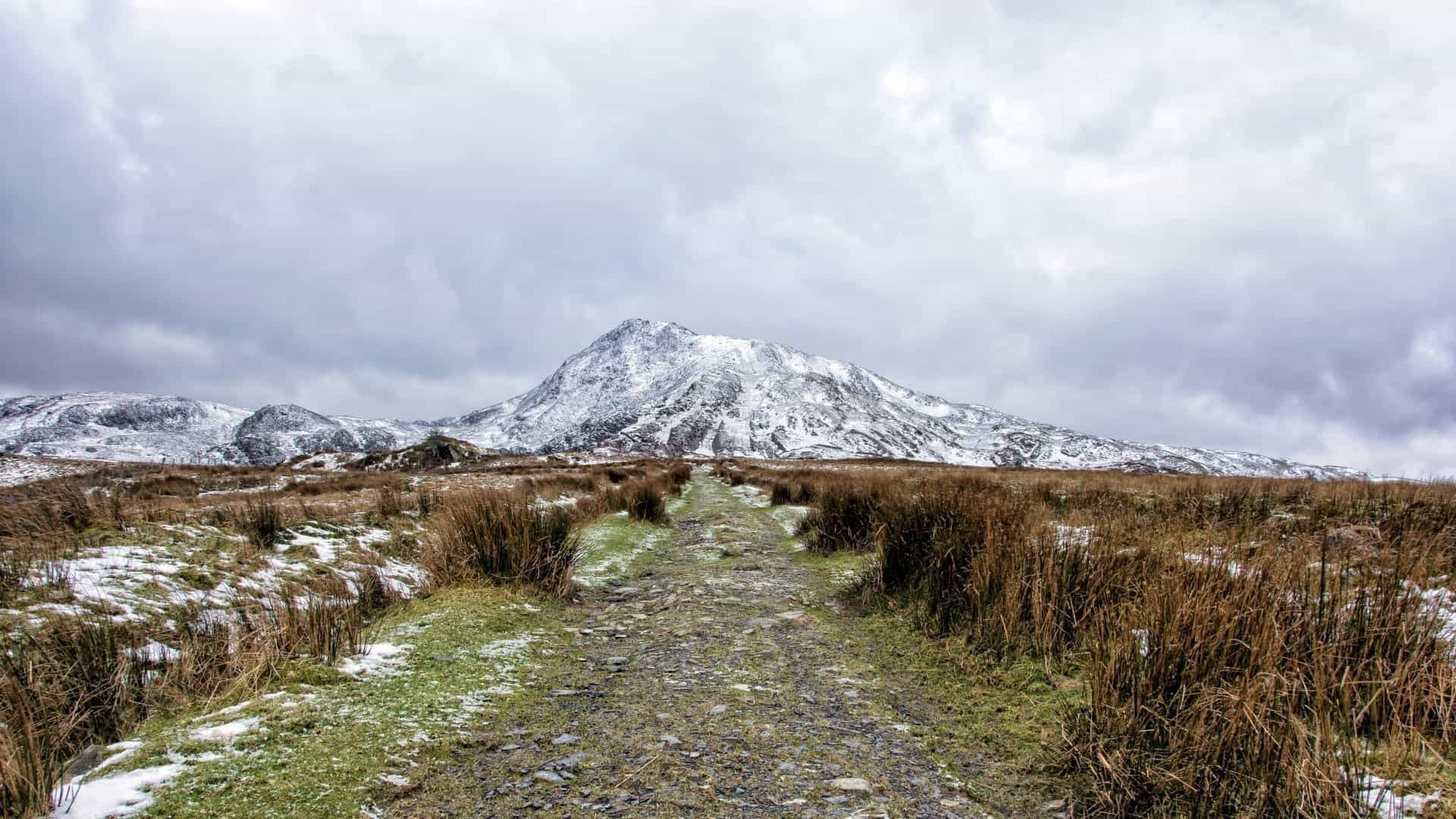
Spring (March–May): The waterfalls are at their most powerful after winter and spring rains. Woodland wildflowers (bluebells, wood anemones) add colour. Trails can be very muddy.
Summer (June–August): Warmer weather and longer daylight, but water levels drop and the waterfalls are less dramatic. Busiest period — car parks fill early. Early mornings or late afternoons are quieter.
Autumn (September–November): Possibly the best season. Waterfalls refill after autumn rains, autumn colour in the woodland is spectacular, and visitor numbers drop from the summer peak.
Winter (December–February): Dramatic and atmospheric, but trails can be icy and daylight is limited. Not recommended for inexperienced walkers in poor conditions.
Flora, Fauna, and Geology
The Four Waterfalls Walk passes through ancient semi-natural woodland dominated by oak, ash, and beech. The damp, shaded gorge floor supports extraordinary communities of mosses, liverworts, and ferns — some sections feel genuinely prehistoric. In spring and summer, look for wild garlic, bluebells, and wood anemones.
The birdlife is rich: buzzards and red kites soar above the canopy (red kites are identifiable by their distinctive forked tails). Woodland birds include pied flycatchers, wood warblers, and dippers (bobbing on rocks in the river). Otters are present on the Mellte but shy and rarely seen. Bats are common at dusk, particularly around the gorge sections.
The waterfalls have formed where the rivers cross bands of harder rock — millstone grit and carboniferous limestone — creating the stepped landscape that defines Waterfall Country. The geological processes that carved these gorges have been operating for thousands of years.
Geology: How the Waterfalls Formed
The waterfalls of the Mellte and Hepste valleys have formed where the rivers cross bands of harder rock. The underlying geology alternates between soft shale and hard millstone grit and carboniferous limestone — laid down approximately 300 million years ago when this part of Wales lay beneath a shallow tropical sea. As the rivers erode downwards through softer rock, they hit resistant layers that form the stepped ledges over which the waterfalls cascade. Over thousands of years, the water has carved deep gorges through the woodland, creating the dramatic landscape visible today.
The cave system where the River Mellte disappears underground (visible near Cwm Porth car park) is another product of this geology — limestone dissolves over millennia, creating underground channels that the river exploits. This phenomenon, known as a swallow hole, is one of the most accessible examples in Wales.
Beyond the Four Waterfalls: More Walks in Waterfall Country
Henrhyd Falls — Tallest Waterfall in South Wales
Approximately 20 minutes’ drive from Ystradfellte near Coelbren, Henrhyd Falls drops 27 metres — the tallest waterfall in South Wales. It gained fame as the entrance to the Batcave in The Dark Knight Rises (2012). The falls are managed by the National Trust and accessed via a short but steep woodland path (approximately 15 minutes each way). It is not recommended to walk behind Henrhyd Falls due to rockfall risk — unlike Sgwd yr Eira. Free to visit (National Trust car park, donations welcome).
Sgwd Gwladus (Lady Falls)
Located near Pontneddfechan, Sgwd Gwladus is a horseshoe-shaped waterfall on the Afon Pyrddin that can be reached via an easy 30-minute walk from the Pontneddfechan car park. It is less visited than the Four Falls and makes an excellent addition if you have time for a second walk. The Elidir Trail from the same car park visits multiple smaller falls and is well-signposted.
Pen y Fan — Highest Peak in Southern Britain
If the Four Waterfalls Walk has whetted your appetite for Bannau Brycheiniog, consider climbing Pen y Fan (886m) — the highest peak in southern Britain and one of the most popular mountain walks in Wales. The most common route from Pont ar Daf car park takes approximately 2–3 hours. For more, see our hiking in Wales guide.
Where to Stay Near the Four Waterfalls Walk
The nearest village is Ystradfellte (The New Inn pub, open weekends). For a wider choice, the market town of Brecon is 30 minutes’ drive and has a full range of hotels, B&Bs and restaurants. Most visitors base themselves in a cottage for 2–3 nights to combine the Four Waterfalls with Pen y Fan, the Beacons Reservoir walk and Brecon town.
Holiday cottages in the Brecon Beacons
HolidayCottages.co.uk lists over 200 personally inspected properties in and around Bannau Brycheiniog — from stone farmhouses with log burners to dog-friendly cottages with hot tubs. Browse availability and filter by dates, number of guests, and pet-friendly options.
This guide contains affiliate links. If you book through them, Wales.org earns a small commission at no extra cost to you.
Frequently Asked Questions About the Four Waterfalls Walk
How long does the Four Waterfalls Walk take?
3–4 hours from Cwm Porth (4.5 miles circular). Longer from Gwaun Hepste (5.3 miles). Add time for waterfall descents and photography.
Can you walk behind a waterfall?
Yes — Sgwd yr Eira has a rocky ledge behind the water. One of the only waterfalls in Wales where this is possible. Sturdy boots essential — the ledge is slippery.
Where do I park?
Cwm Porth (CF44 9JF, ~£5, toilets, maps) — recommended. Gwaun Hepste (~£5, largest). Comin y Rhos (SA11 5US, free, <10 spaces). Arrive before 10am in peak season.
Is the walk suitable for children?
Older children with stamina, yes. The linking trails to waterfalls are steep, muddy, and have rock steps — not suitable for very young children without supervision. Not accessible for pushchairs.
Is the walk dangerous?
NRW has issued safety warnings following fatalities. Stay on paths. Do NOT enter rivers or pools (drowning risk). Wear proper boots. Check conditions before walking.
When is the best time to visit?
Spring and autumn for the fullest waterfalls (after rain). Summer is warmer but drier. Winter is atmospheric but icy. Weekdays are quieter. Arrive early for parking.
All information in this guide was verified in April 2026. Trail conditions can change — check Natural Resources Wales for current closures and safety updates. For more walks in the Brecon Beacons, explore our hiking guide, free days out in South Wales, and the Bannau Brycheiniog destination guide. For trail maps, visit AllTrails.
Pembrokeshire-born travel writer and founder of Wales.org. Born in Haverfordwest, now based in Hertfordshire — covering Welsh castles, national parks, festivals and family staycations across all 22 Welsh counties.